Marker Trees

Last year I found a marker tree. It lead me to this.
I have been working with the Mountain Stewards recording a Catawba Indian Village I found in SC.
Check out their website at www.mountainstewards.org
I am sitting on a tree marker for a long arm tree in this photo. It’s been quite an adventure learning about this particular tribe. I am familiar with the Cherokee being my grandfather was Cherokee.

That’s why I noticed the first marker tree and in the next photo with me is Don Wells on day one of documenting the Catawba Indian Village site. I added a few more marker tree pics of marker trees I found on my various other trips documenting.
I look forward to helping to complete and document this tribes untold story.
Here is a quick write-up from Don Wells at Mountain Stewards.
”We began researching the Catawba Indian tribe in 2018 but never could understand this tribe until we researched a Catawba village site last Friday with the help of Jim and Tarra. Then everything fell into place and we are able to write their story. This is a story about a lost part of the Catawba Nation whose complete story may never be written. Hopefully, more village sites will be discovered in the future so that the rest of the story can be told. I have remote dowsed AR and found at least two Catawba sites that they moved to before reaching OK. Both of these sites do not appear to accessible other than by boat so we may never get further in telling this story.”
INTRODUCTION
The Rest of the Catawba Indian Story Don and Diane Wells © 2020
Newscaster and commentator Paul Harvey used the phrase in his weekly broadcast, “And now the rest of the story.” This report might be considered the “rest of the Catawba story.”
The early Catawba story begins with the Spanish explorers encountering the Catawba in what is now the area between NC and SC in the mid-1500’s. Some historians list their population at the time as being around 8,000. Others estimated the Catawba as having a population of 15,000 to 20,000 and some have that number even higher.
By 1728, after fighting in the Tuscarora War in 1711-1713 and the Yamasee War in 1715-1717 and suffering disease epidemics, their population was down to 1,400. Further epidemics of white man’s diseases brought the population down below 500 by 1759. By 1826, history records the population of the Catawba people as being only 110. These people were most likely the ones located at the Catawba reservation near the Lancaster and York County area of SC.
In the 1841 treaty with the government of South Carolina government, the Catawba sold their remaining 144,000 acres of land for future payments to buy other lands elsewhere. However, they were not removed to Oklahoma possibly because the tribe was too small and there was no land in Oklahoma for them to move to.
In the end, the Catawba had no home and by 1847, the South Carolina Governor declared: “They are, in effect, dissolved.”
That statement was a bit premature. The Catawba did survive and today are a federally recognized tribe in South Carolina.
Catawba Culture
The Catawba Culture is a complex intermingling of a number of cultures. In the early 1500’s, the Catawba were probably two separate tribes: the Catawba proper and the Iswa. By the end of the Yamassee War in 1717, they included remnants from as many as 30 other Indian tribes including Saura (Cheraw), Sugaree, Waxhaw, Congaree, Shakori, Keyauwee, and Sewee. Their culture was similar to the Creek Indian Confederacy in that a large number of cultures were joined together.
However, in the case of the Catawba, they all spoke a Sioux type language as compared to the Creeks who spoke several languages. Tribal decisions may have been difficult considering all the cultural differences co-mingled in the Nation. As a result of these differences, there may have been a fracturing of this co-mingling of cultures with parts of the tribe separating in the late 1700’s.
During the period of the mid 1770’s, the Revolutionary War was beginning and Indian tribes we're being forced to declare their allegiance to either the colonists or the British. The Catawba Nation
located then in the area of what is now Lancaster and York Counties sided with the colonists. This is surprising since during the French and Indian War of 1755-1763, the Catawba Nation refused to get involved with the colonist skirmishes. The fact that the Catawba Nation was now taking sides in the Revolutionary War and fighting for the colonists may have led to the splintering of the tribe around 1774-5.
While nothing is recorded in their history about this fracturing, our research has found a number of Catawba villages located south of the Nation. All of these villages have been determined to have relocated in the late 1700’s to early 1800’s.

These villages are mostly located along the Savannah River a distance of at least 100 miles from the Catawba Nation. These Indians may have been part of the original Catawba culture who became disillusioned with the direction the Nation was taking and decided to separate from the tribe on a permanent basis. There seems to have been no further contact with the Catawba Nation after the separation.
In fact, the Oklahoma Historical Society stated that, “In 1851 a remnant band of Catawba Indians reached the Choctaw Nation, Indian Territory, where they were later granted citizenship. Indian Territory was home to 132 Catawba in 1896. By 1950 an unknown number were counted among the Choctaw, Creek, and Cherokee populations of Oklahoma.

Most resided in the Choctaw Nation between present Spiro and Stigler. Others lived at or near Checotah in the Creek Nation and Texana in the Cherokee Nation.” Those Catawba Indians associated with the Nation never were moved to OK and remained in SC to re-establish the tribe many years later. These Catawba people may have been mostly the Iswa part of the tribe.
The Other Catawba Nation, Chester South Carolina
In 2018, John Massey invited us to come to Chester, SC to see an Indian Marker tree he found that was located in Wylie Park in downtown Chester. In its prime, Wylie Park provided recreational opportunities for the citizens of Chester. Unfortunately, the city does not have sufficient monies to maintain the park and it has fallen into disrepair.

The Marker Tree was found in a part of the park seldom visited by residents. Using Native Science and dowsing, the tree was determined to be a Ceremonial Burial Tree. Years of research has shown us that principle Indian villages most often had common cultural features in them. These included a Ceremonial Healing site, a Dance Ground and a Council site. For some tribes, they also had a Ceremonial Burial site. Thus, having found a Ceremonial Burial tree, there had to be a village site nearby and the other common cultural features would be located near where the Marker Tree was found.
On a second visit to the site in late 2018, it was determined that Wylie Park was the site of a Catawba Indian village which was located on a small creek flowing through the south end of the park. During that visit, the Ceremonial Healing site, the Dance Grounds Wylie Park Tree and the Council site was located. Also, the common grave area for those whose burial ceremony was conducted at the Ceremonial Burial tree was located some hundred yards from the tree. It is estimated that there were 38 people buried in the common grave area. Each of the common cultural features of the village had up welling earth energies associated with it as was the custom for principle villages.
It was determined that this Catawba Indian village, some 20 miles southeast of the main Catawba tribe, had located in this area around 1774 and remained in this location until around 1790. It was estimated that approximately 30 families were in the village.
Unfortunately for the Chester Catawba people, they located their village in an area soon to become part of the growing state of South Carolina. The colonists having won the war against the British, began expanding to the west. Chester County and the city of Chester were formed around 1785 putting pressure on the Catawba tribal location.
Looking at the history of Chester County, one of the major trading trails came right through Chester County. At that time, it was known as the Great Wagon Road (AKA Philadelphia Trading Path or Trail to the Cherokee and Catawba Indians.) It followed Rt 72 through Chester so it went right by the Catawba Council site and village location.
The Henry Mouzon map of 1775 shows the trail. Thus, all throughout the Revolutionary War and before, this trail was used to move supplies and people involved in the war and as a trading path before the war. Eventually, the Catawba village was encroached upon and they had to move again. It is believed they relocated to the north side of the Savannah River five miles east of what is today Fairplay, South Carolina. This is the area where several other Catawba villages were located along a 45-mile stretch of the Savannah River.
Calhoun Falls, South Carolina
Most of the Catawba village locations along the Savannah River are not currently accessible as they are either on private lands or buried under the lakes created by damming up the Savannah River. One of these sites, however, is located on timber property and access was granted to visit the site.
Located near Calhoun Falls, SC, this Catawba village was determined to be a Principle village similar to the one located near Chester, SC. It was estimated to have approximately 28 families and existed at this location from 1820-1835. Like the village at Chester, this village was probably located previously to the north until encroachment forced it to relocate along the Savannah River area.
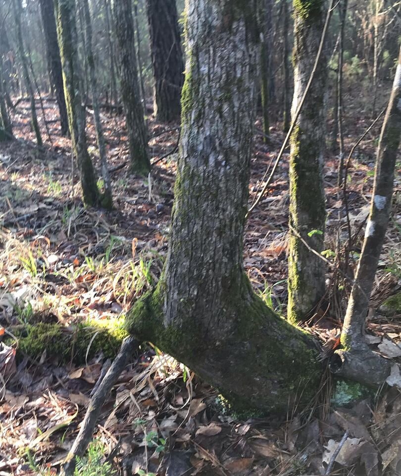
No information is currently known about it's previous location. The Calhoun Falls village site was discovered when Tarra found the Marker Tree at the village site and reported its location.
Marker Tree at Calhoun Falls Village
A site investigation of the village in February 2020, determined that it was a principle Catawba village having a Ceremonial Burial site, a Ceremonial Healing site, a Dance Grounds and Council site.
This site has some rough terrain so it was not likely prime farming land and not occupied by colonists. Even today, there are few farms in the area and the land is mostly unused. Thus, the tribe probably was not impacted by colonial expansion in the early 1800’s.
By the 1830’s, the Indian removal was well underway in the southeast. There is no evidence that the Catawba along the Savannah River were being coerced to move to Oklahoma but they seemed to all have decide to leave the area on their own somewhere in 1835 or shortly thereafter.
As reported earlier, one group is recorded as arriving at the Choctaw reservation in 1851 which is 16 years later. There are no records as to what happened with the Catawba people who departed the Savannah River area other that the group that arrived in 1851. It is believed they traveled toward Oklahoma but stopped in Arkansas for about ten or more years before moving on to Oklahoma. They were probably grouped into cultural similarities from the remnant tribes that joined the Catawba tribe in the early 1700’s.
Maintaining their cultural identity was probably important to them. One group is believed to have moved to the White River area near Augusta, Arkansas. Another group located along the Arkansas River near Roseville, Arkansas.
The Roseville Catawba are the ones believed to have joined the Choctaw in 1851. The other group may have joined the Chickasaw in the late 1840’s. This part of the story may never be told and the “Lost Tribes” of Catawba will be forever a mystery.
Eastanollee, Georgia
Another of the sites associated with the Catawba occupation of the Savannah River is important to note. It in fact is located upstream of the Savannah River where the Tugalo and Seneca Rivers join to form the Savannah River before Hartwell Dam. This site is located on a multi-cultural village site near Eastanolle Georgia.
The Catawba did not have a village at this location but rather used the site as a ceremonial site for tribal visions to guide their current and future plans. These visions may have been shared with all of the Catawba villages along the river. The site is estimated to have been used by the Catawba from 1775-1820.
On this site is a specially configured tree. The tree formed over the 49-ring Geospiral is a poplar tree. This tree was configured from five trunk stems which were all connected at the ground level. The tree is in the form of a right hand pointing upward with the thumb on the right and the four fingers pointing up mostly vertical. Thus, the hand forms a small place in the palm in which a tribal medicine man or shaman could stand to be bathed by the upwelling energy. Most Geo- spirals encountered form concentric rings of energy.
Catawba Vision Tree Looking in the Hand Formation centered Geospiral about 5-6 feet apart. For the Eastanollee Hand tree, the rings are spaced 1 foot apart. Thirty-five feet to the north on the spaced the Hand tree, is a Vortex site (down welling energy) which is also a 49-ring energy site with the rings spaced at 1 foot apart.
Together, these two sites create a couplet of energy flow which is most likely one of the most powerful energy sites ever encountered. The up welling energy from the Geospiral is probably the same energy down-welling into the Vortex.
With overlapping rings of energy, this site is remarkable. The entire site is surrounded by privet bushes/trees all of which are leaning away from the site to the south probably due to the powerful energy at the site.
Site Purpose
There is nothing written about the use of this site so we used Native Science and dowsing to determine its purpose and how it was used. Although the site at Eastanollee could be used for healing, its powerful energy field was more likely used for Vision Quests by the Catawba Medicine Man or Shaman. The Medicine Man stood in the center of the “Hand” tree and, while bathed in the up welling energy, could see into the future, receive visions of what their tribe should be doing or learn how to handle a situation they currently were encountering. They may have believed that this site could also be used as a portal to another world.

It was determined that the Catawba heard about this site from the Sappony tribe located in what is now North Carolina. Apparently, this site was known among other tribes but few ever visited it. When the Catawba moved to the Savannah River area, they must have decided to check it out. The site was so powerful, they decided to mark it with the “Hand” tree. Why they stopped using this site in 1820 is unknown but is probably related to the tribe moving their village.
Woodhenge
It is believed the Catawba people created a woodhenge-like structure surrounding the Hand tree and Geospiral. The woodhenge had 24 poles spaced 15 degrees apart and the poles were painted black. The black snake is sacred to the Catawba. Dr. Thomas J. Blumer wrote an article on Catawba culture entitled, The Blacksnake in Catawba Indian Art and Culture.
Dr. Blumer stated that, “One of the most sought-after Catawba Indian clay vessels is the venerable snake pot. The serpent portrayed on the snake pot is most often the blacksnake. No one knows the origin of the blacksnake of the Catawba culture and art.” Catawba warriors captains often had two black snake tattoos on their back which ended on top of their shoulders. So, painting the poles black is part of Catawba culture and probably represents the black snake. Symbolically, this may designate this site as being very sacred to the Catawba.
Interestingly, today at Catawba College in NC, the flagpoles are painted black.
The number 24 seems to be significant to the Catawba but no written record could be found to validate that assumption.
The woodhenge in Cahokia, Illinois was used to observe time related to lunar and solar events. The woodhenge at Eastanollee was probably not used for observing lunar or solar event as its location is in a valley surrounded by steep hills. Therefore, it could not have been used as an observation site.
The woodhenge at Eastanollee appears to have been related to the ceremonies of visions and vision quests. The Medicine Man probably visited the site several times a year at a time when the moon was in its quarter phase. The times of his visits are based on new knowledge that the gravitational force due to moon cycles has an effect on the upwelling energy.
At new or full moon cycles, the spinning of the upwelling energy at a Geospiral appears to stop. It is at its highest rotation spin at quarter moon phases.
We think the Medicine Man came to the site on his own on occasion to receive visions for the tribe. On other occasions, he is thought to have brought 24 warriors with him. Each warrior stood at one of the poles and faced outwardly from the Hand tree while the Medicine Man stood in the center of the tree to receive the vision.
Perhaps, the accompanied warriors enhanced the sacredness of the site making the vision obtained more important to the tribe.